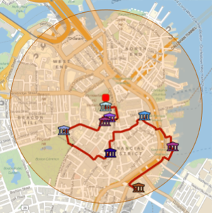
Genere un recorrido a pie por edificios notables
Use GeoNearest para recuperar edificios notables en un radio de 1 km alrededor del Ayuntamiento de Boston.
In[1]:=
position = Entity["Building", "BostonCityHall::96t3t"];
radius = Quantity[1, "Kilometers"];
In[2]:=
nearMe = GeoNearest["Building", position, {All, radius}]Out[2]=

Represente gráficamente esos edificios en un mapa local, usando las entidades ícono incorporadas.
muestre la entrada completa de Wolfram Language
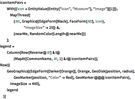
Out[3]=

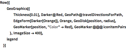
Use TravelDirections para calcular un recorrido a pie de esas entidades.
In[4]:=
tourPlaces = Prepend[nearMe, position];In[5]:=
{distance, tourPath} =
 FindShortestTour[GeoPosition /@ tourPlaces, 1, Length@tourPlaces]
Out[5]=
In[6]:=
travelDirectionsForPath =
 TravelDirections[tourPlaces[[tourPath]], TravelMethod -> "Walking"]
Out[6]=

muestre la entrada completa de Wolfram Language
Out[7]=

Estas son instrucciones detalladas de cómo seguir la ruta.
In[8]:=
travelDirectionsForPath["ManeuverGrid"]Out[8]=