The Wolfram Solution for Geosciences
Simulate your geoscience applications with fully interactive models incorporating state-of-the-art image processing, built-in geodesy data and the computational power that only the Wolfram solution can provide.
Includes probabilistic model analysis, the world's most advanced differential equation solving with automatic symbolic preprocessing, algorithm selection and precision control.
- The Wolfram Edge
- How Wolfram Compares
- Key Capabilities
Wolfram technologies include thousands of built-in functions and curated data on many topics that let you:
- Design global and national control networks based on datums and coordinate systems to study geodynamic phenomena, such as crustal motion, tidal movements, polar motion and more
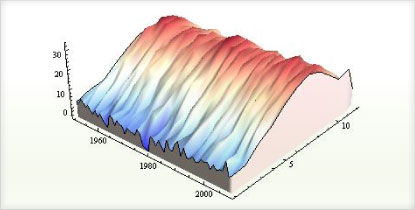
- Understand global climate patterns using built-in weather data
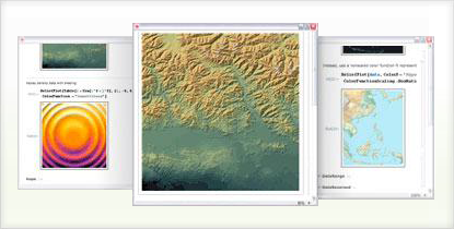
- Enhance and analyze satellite images to study geological features of interest
- Quantify earthquake hazard in regions of low seismicity
- Derive and plot systems of equations to simulate the influence of faults on groundwater flow
- Perform statistical generalization and simulation of uniform hazard earthquake ground motions
- Develop spatially distributed GIS-style methods for probabilistic slope-stability analysis
- Derive and evaluate stresses and displacements in compressible elastic layers of drape folds and other geomechanical applications
- Model the influence of mineralogy on frictional heat dissipation near faults and other structural geology applications
Does your current tool set have these advantages?
-
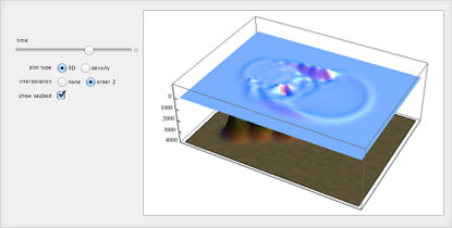
Instantly create interactive applications to study geological phenomena, such as the propagation of seismic waves, tidal motion and more
Instant creation of interactive interfaces is not possible in other software -
Free-form linguistic input produces immediate results without the need for syntax
Unique to Wolfram technologies -
Seamless integration of coding, computation, probabilistic analysis and interactive visualization of geological phenomena in one document
Unique to Wolfram technologies -
Built-in, industrial-strength image processing algorithms for analyzing satellite and radar data
Matlab requires the purchase of extra toolboxes; other software systems require the purchase of image processing software such as IDL -
Easily switch between Cartesian and spherical coordinates for spatial analysis, seismicity analysis and high-precision map projection
Unique to Wolfram technologies -
Automated precision control and arbitrary precision numerics produce highly accurate results for applications in geomechanics, structural geology and more
Excel, Matlab and other systems that rely on finite precision numerics can cause serious errors due to lack of precision -
Easy-to-use parallel computing control and capabilities for solving computation- or data-intensive problems on multicore computers
Extensive programming is required in all major software systems to parallelize processes -
Built-in, powerful statistical analysis and optimization routines for analyzing large amounts of data from radars, satellites and more
Matlab requires the purchase of extra toolboxes -
Tight integration of specialized geoscience functionality within the Wolfram Language and more than 20 built-in application areas such as GIS, statistics, image processing and more
ArcGIS, STATA, SPSS, IDL and other specialized software packages are required to obtain the Wolfram Language's built-in functionality; Matlab requires purchase of extra toolboxes
Geoscience specific capabilities:
- Comprehensive, built-in database of geodetic datums and reference ellipsoids »
- Free-form linguistic input produces immediate results without the need for syntax »
- Advanced geodesy tools for high-precision map projection; analysis of geodynamic phenomena, such as crustal motion; polar motion; and more »
- Built-in functions for deriving first-order, second-moment expansions and Monte Carlo simulations for probabilistic stability analysis of forested slopes and other applications »
- State-of-the-art image processing algorithms to analyze geological structures »
- Multidimensional curve fitting and plotting of void ratio, confining stress and stress-dependent permeability data for hydrogeology applications »
- Build interactive seismic hazard analysis models »
- Advanced statistical analysis using built-in functions for nonlinear regression, generalized linear model fit and more for geomechanical applications such as determining the stresses around a bore hole
- Automatic algorithm selection by built-in superfunctions such as NDSolve ensure accurate results to complex numerical problems in geomechanics, structural geology and more
- Easily import data in hundreds of file formats, including GPX, GRIB, GeoTIFF, SHP, STDSDEM, USGSDEM, CDED and more for analysis and visualization »
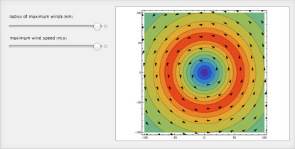
- Automatic interface construction to create interactive applications to dynamically visualize the propagation of seismic waves, volcanic activity and other geological phenomena »
- Share your interactive applications, reports and code with other geoscientists and colleagues using Wolfram Player »
- Built-in parallel computing control and capabilities for solving computation- or data-intensive problems on multicore computers »
- Use built-in geodesy, weather and geographic data immediately suitable for computations and analyses »


Consulting Solutions
Enlist the world’s computation experts to help with your project—any size, any level. At Wolfram, we know what’s possible with computational technology because we are global leaders in creating it. That gives us an unprecedented depth of expertise in applying it to consulting work in a variety of fields. Whether individual or enterprise, from concept to deployment, our computation experts can help you achieve robust results with less time and effort. Get us started with your project today


