月用の新しいタイル
バージョン11には,ズームレベルが1から9までの,月のための向上したタイルのセットが加わっている.
次は,アポロ15号の着陸地点である.
In[1]:=
landing =
 Entity["MannedSpaceMission", "Apollo15"][
  EntityProperty["MannedSpaceMission", "LandingPosition"]]
Out[1]=
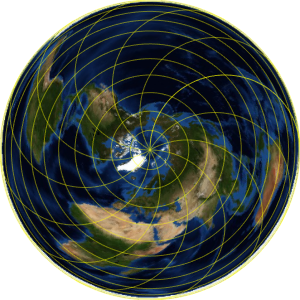
正射図法による月の表側の地図に,地理マーカーをプロットする.
In[2]:=
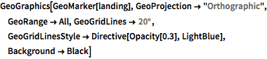
GeoGraphics[GeoMarker[landing], GeoProjection -> "Orthographic",
 GeoRange -> All, GeoGridLines -> Quantity[20, "AngularDegrees"],
 GeoGridLinesStyle -> Directive[Opacity[0.3], LightBlue],
 Background -> Black]
Out[2]=
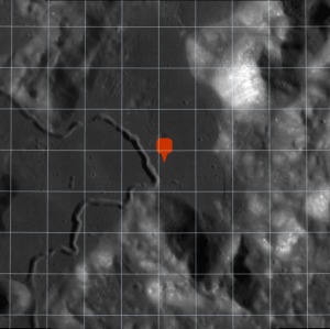
着陸地点は,「雨の海」の東端付近に位置する.
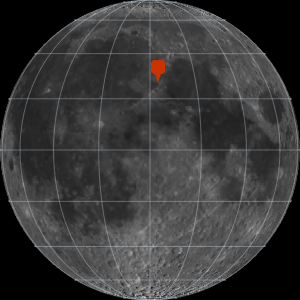
In[3]:=
GeoGraphics[GeoMarker[landing], GeoProjection -> "Orthographic",
 GeoRange -> All, GeoGridLines -> Quantity[20, "AngularDegrees"],
 GeoGridLinesStyle -> Directive[Opacity[0.3], LightBlue],
 Background -> Black];
Show[%, GeoRange -> Quantity[200, "Miles"],
 GeoGridLines -> Quantity[2, "AngularDegrees"]]
Out[3]=
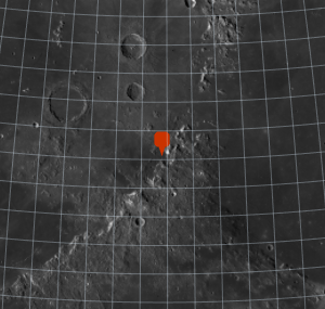
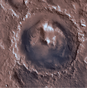
さらにズームする.
In[4]:=
landing =
 Entity["MannedSpaceMission", "Apollo15"][
  EntityProperty["MannedSpaceMission", "LandingPosition"]];
Show[%, GeoRange -> Quantity[200, "Miles"],
 GeoGridLines -> Quantity[2, "AngularDegrees"]];
Show[%, GeoRange -> Quantity[15, "Miles"],
 GeoGridLines -> Quantity[.2, "AngularDegrees"]]
Out[4]=