Distorsion de surface par projection
La projection de Mercator ne préserve pas les surfaces. Il ne s'agit pas d'une projection à superficie égale.
In[1]:=
GeoProjectionData["Mercator", "EqualArea"]Out[1]=
La superficie de l'Afrique est plus de 14 fois supérieure à la surface du Groenland.
In[2]:=
GeoArea[Entity["GeographicRegion", "Africa"]]/
 GeoArea[Entity["Country", "Greenland"]]
Out[2]=
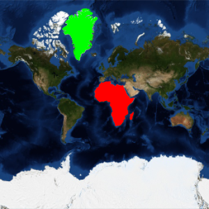
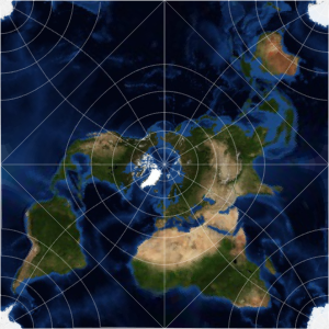
Cependant, dans une projection de Mercator, l'Afrique et le Groenland semblent avoir des tailles similaires.
In[3]:=
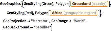
GeoGraphics[{GeoStyling[Green],
  Polygon[Entity["Country", "Greenland"]], GeoStyling[Red],
  Polygon[Entity["GeographicRegion", "Africa"]]},
 GeoProjection -> "Mercator", GeoRange -> "World",
 GeoBackground -> "Satellite"]
Out[3]=

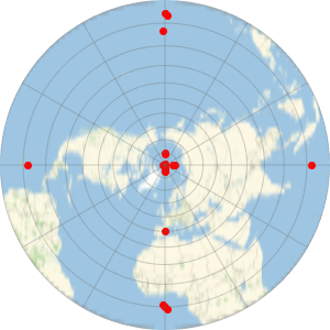
Utilisez une projection équivalente, comme celle de Mollweide, pour représenter de manière plus appropriée les tailles relatives.
In[4]:=
GeoProjectionData["Mollweide", "EqualArea"]Out[4]=
In[5]:=
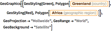
GeoGraphics[{GeoStyling[Green],
  Polygon[Entity["Country", "Greenland"]], GeoStyling[Red],
  Polygon[Entity["GeographicRegion", "Africa"]]},
 GeoProjection -> "Mollweide", GeoRange -> "World",
 GeoBackground -> "Satellite"]
Out[5]=