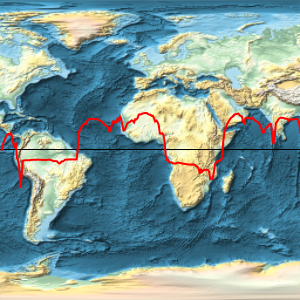
投影造成的面积变形
麦卡托投影法(Mercator projection)不能保持面积. 该方法并不是等面积投影.
In[1]:=
GeoProjectionData["Mercator", "EqualArea"]Out[1]=
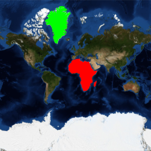
非洲的面积比格陵兰面积的大 14 倍以上.
In[2]:=
GeoArea[Entity["GeographicRegion", "Africa"]]/
 GeoArea[Entity["Country", "Greenland"]]
Out[2]=
但在麦卡托地图中,非洲和格陵兰的面积却近乎相同.
In[3]:=
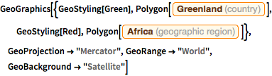
GeoGraphics[{GeoStyling[Green],
  Polygon[Entity["Country", "Greenland"]], GeoStyling[Red],
  Polygon[Entity["GeographicRegion", "Africa"]]},
 GeoProjection -> "Mercator", GeoRange -> "World",
 GeoBackground -> "Satellite"]
Out[3]=

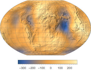
使用等面积投影法,比如摩尔魏特(Mollweide),来表示更合适的和相对大小.
In[4]:=
GeoProjectionData["Mollweide", "EqualArea"]Out[4]=
In[5]:=
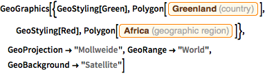
GeoGraphics[{GeoStyling[Green],
  Polygon[Entity["Country", "Greenland"]], GeoStyling[Red],
  Polygon[Entity["GeographicRegion", "Africa"]]},
 GeoProjection -> "Mollweide", GeoRange -> "World",
 GeoBackground -> "Satellite"]
Out[5]=