Cartographic Geo Projections
Version 11 provides a large collection of several hundred cartographic projections for both spherical and ellipsoidal reference models. They can be classified in several ways, and here several examples of some of those types of projections are explored.
In[1]:=

worldmap[proj_] := Framed[Labeled[
   GeoGraphics["World", GeoBackground -> "Satellite",
    GeoProjection -> proj, GeoGridLines -> Automatic,
    GeoGridLinesStyle -> Directive[White, Opacity[0.25]]],
   proj]]
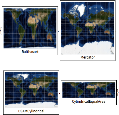
Cylindrical projections.
In[2]:=
worldmap /@ {"Balthasart", "Mercator", "BSAMCylindrical",
  "CylindricalEqualArea"}
Out[2]=
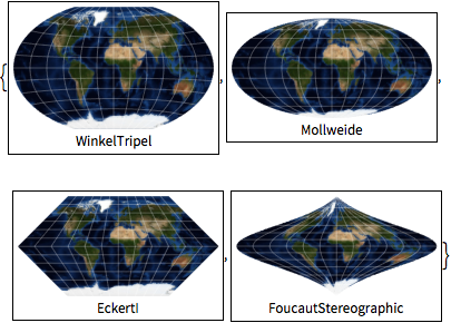
Pseudo-cylindrical projections.
In[3]:=
worldmap /@ {"WinkelTripel", "Mollweide", "EckertI",
  "FoucautStereographic"}
Out[3]=
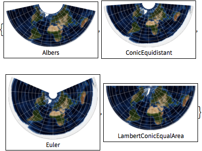
Conic projections.
In[4]:=
worldmap /@ {"Albers", "ConicEquidistant", "Euler",
  "LambertConicEqualArea"}
Out[4]=
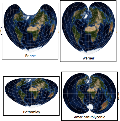
Pseudo-conic and polyconic projections.
In[5]:=
worldmap /@ {"Bonne", "Werner", "Bottomley", "AmericanPolyconic"}Out[5]=
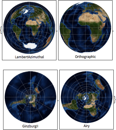
Azimuthal projections.
In[6]:=
worldmap /@ {"LambertAzimuthal", "Orthographic", "GinzburgII", "Airy"}Out[6]=
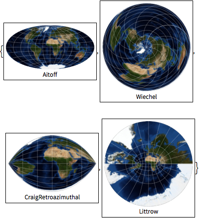
Modified azimuthal and retroazimuthal projections.
In[7]:=
worldmap /@ {"Aitoff", "Wiechel", "CraigRetroazimuthal", "Littrow"}Out[7]=
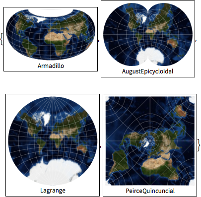
Miscellaneous projections.
In[8]:=
worldmap /@ {"Armadillo", "AugustEpicycloidal", "Lagrange",
  "PeirceQuincuncial"}
Out[8]=
