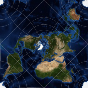
Área de distorsión por una proyección
La proyección de Mercator no conserva áreas. No es una proyección de áreas equivalentes.
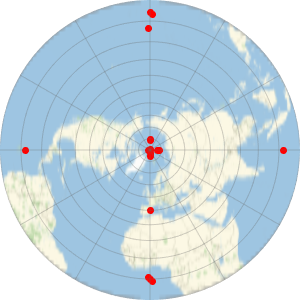
In[1]:=
GeoProjectionData["Mercator", "EqualArea"]Out[1]=
El área de África es 14 veces más larga que el área de Groenlandia.
In[2]:=
GeoArea[Entity["GeographicRegion", "Africa"]]/
 GeoArea[Entity["Country", "Greenland"]]
Out[2]=
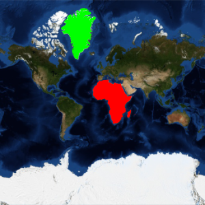
En un mapa de Mercator, sin embargo, África y Groenlandia parecen tener tamaños similares.
In[3]:=
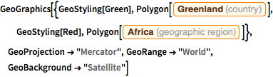
GeoGraphics[{GeoStyling[Green],
  Polygon[Entity["Country", "Greenland"]], GeoStyling[Red],
  Polygon[Entity["GeographicRegion", "Africa"]]},
 GeoProjection -> "Mercator", GeoRange -> "World",
 GeoBackground -> "Satellite"]
Out[3]=

Utilice una proyección de áreas iguales, como la de Mollweide, para representar de forma más apropiada los tamaños relativos.
In[4]:=
GeoProjectionData["Mollweide", "EqualArea"]Out[4]=
In[5]:=
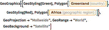
GeoGraphics[{GeoStyling[Green],
  Polygon[Entity["Country", "Greenland"]], GeoStyling[Red],
  Polygon[Entity["GeographicRegion", "Africa"]]},
 GeoProjection -> "Mollweide", GeoRange -> "World",
 GeoBackground -> "Satellite"]
Out[5]=