Polígonos con "GeographicRegion"
Un nuevo dominio de entidades geográficas, "GeographicRegion", puede describir continentes completos y otros tipos de entidades geográficas.
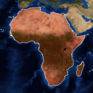
África como región geográfica representa el continente completo.
In[1]:=
africa = EntityValue[Entity["GeographicRegion", "Africa"],
  EntityProperty["GeographicRegion", "Polygon"]]
Out[1]=

In[2]:=
GeoGraphics[{EdgeForm[White], FaceForm[Red], africa},
 GeoBackground -> "Satellite"]
Out[2]=

También es posible obtener los polígonos de todos los países en África.
In[3]:=
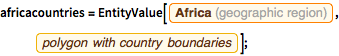
africacountries =
  EntityValue[Entity["GeographicRegion", "Africa"],
   EntityProperty["GeographicRegion", "PolygonCountryBoundaries"]];
In[4]:=
GeoGraphics[{EdgeForm[White], FaceForm[Red], africacountries},
 GeoBackground -> "Satellite"]
Out[4]=