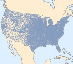
"HistoricalCountry" Polygons
The new geo entity domain "HistoricalCountry" provides useful data about a large collection of historical entities.
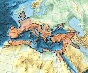
Extension in time of the Roman Empire.
In[1]:=
Entity["HistoricalCountry",
  "RomanEmpire"][{EntityProperty["HistoricalCountry", "StartDate"],
  EntityProperty["HistoricalCountry", "EndDate"]}]
Out[1]=
This is the maximum geographical extent of the Roman Empire.
In[2]:=
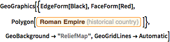
GeoGraphics[{EdgeForm[Black], FaceForm[Red],
  Polygon[Entity["HistoricalCountry", "RomanEmpire"]]},
 GeoBackground -> "ReliefMap", GeoGridLines -> Automatic]
Out[2]=
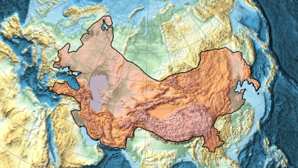
And this is the maximum extent of the Mongol Empire.
In[3]:=
Entity["HistoricalCountry",
  "MongolEmpire"][{EntityProperty["HistoricalCountry", "StartDate"],
  EntityProperty["HistoricalCountry", "EndDate"]}]
Out[3]=
In[4]:=
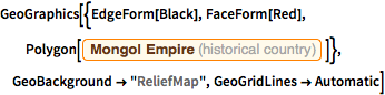
GeoGraphics[{EdgeForm[Black], FaceForm[Red],
  Polygon[Entity["HistoricalCountry", "MongolEmpire"]]},
 GeoBackground -> "ReliefMap", GeoGridLines -> Automatic]
Out[4]=