Choose Your Own Tile Server
GeoGraphics uses the Wolfram map tile server by default.
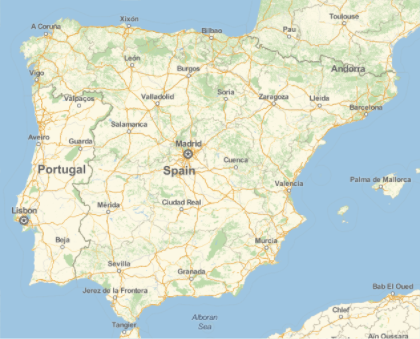
In[1]:=
GeoGraphics[Entity["Country", "Spain"]]Out[1]=
Use an alternative tile server.
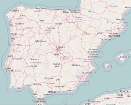
In[2]:=
GeoGraphics[Entity["Country", "Spain"],
 GeoServer -> "http://a.tile.openstreetmap.org/`1`/`2`/`3`.png"]
Out[2]=
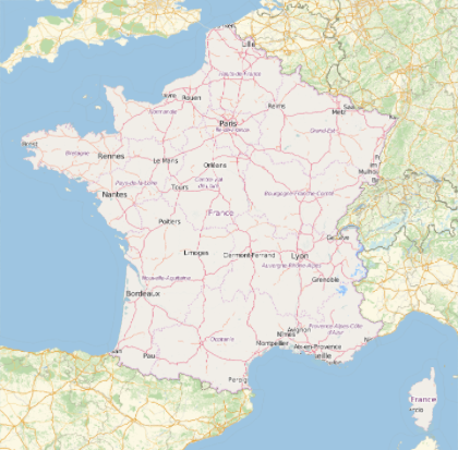
Use different tile servers in different parts of a map.
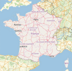
In[3]:=
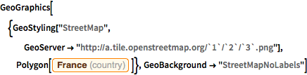
GeoGraphics[{GeoStyling["StreetMap",
   GeoServer -> "http://a.tile.openstreetmap.org/`1`/`2`/`3`.png"],
  Polygon[Entity["Country", "France"]]},
 GeoBackground -> "StreetMapNoLabels"]
Out[3]=