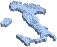
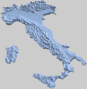
3D GeoElevation Models
Construct a geo elevation model of a country.
In[1]:=
country =
 GeoElevationData[Entity["Country", "Italy"], Automatic, "Region"]
Out[1]=
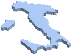
Rescale in the vertical direction to magnify the elevation profile.
In[2]:=
{xrange, yrange, {zmin, zmax}} = RegionBounds[country]Out[2]=
In[3]:=
Show[RegionResize[country, {xrange, yrange, {0, 300 zmax}}],
 PlotRange -> {xrange, yrange, {265 zmax, 300 zmax}}]
Out[3]=