New Tiles for the Moon
Version 11 adds an improved set of tiles for the Moon, with zooms from 1 to 9.
This is the location of the landing site for the Apollo 15 mission.
In[1]:=
landing =
 Entity["MannedSpaceMission", "Apollo15"][
  EntityProperty["MannedSpaceMission", "LandingPosition"]]
Out[1]=
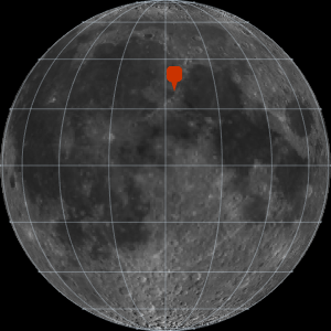
Plot a geo marker on an orthographic map of the near side of the Moon.
In[2]:=

GeoGraphics[GeoMarker[landing], GeoProjection -> "Orthographic",
 GeoRange -> All, GeoGridLines -> Quantity[20, "AngularDegrees"],
 GeoGridLinesStyle -> Directive[Opacity[0.3], LightBlue],
 Background -> Black]
Out[2]=

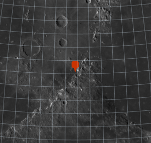
The landing site is located near the eastern edge of the Mare Imbrium.
In[3]:=
GeoGraphics[GeoMarker[landing], GeoProjection -> "Orthographic",
 GeoRange -> All, GeoGridLines -> Quantity[20, "AngularDegrees"],
 GeoGridLinesStyle -> Directive[Opacity[0.3], LightBlue],
 Background -> Black];
Show[%, GeoRange -> Quantity[200, "Miles"],
 GeoGridLines -> Quantity[2, "AngularDegrees"]]
Out[3]=

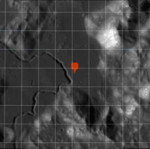
Zoom in further.
In[4]:=
landing =
 Entity["MannedSpaceMission", "Apollo15"][
  EntityProperty["MannedSpaceMission", "LandingPosition"]];
Show[%, GeoRange -> Quantity[200, "Miles"],
 GeoGridLines -> Quantity[2, "AngularDegrees"]];
Show[%, GeoRange -> Quantity[15, "Miles"],
 GeoGridLines -> Quantity[.2, "AngularDegrees"]]
Out[4]=


