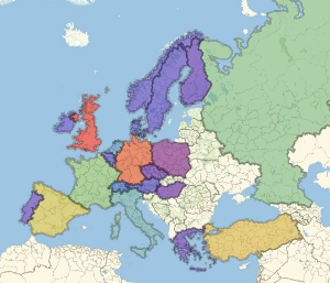
国境
新しい輪郭線地図スタイル"CountryBorders"を使う.
In[1]:=
GeoGraphics["World", GeoBackground -> "CountryBorders"]Out[1]=

国境は,現在以外のものも表示できる.次はルイジアナ購入直前の1803年の北アメリカの部分である.
In[2]:=
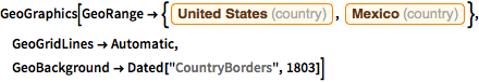
GeoGraphics[
 GeoRange -> {Entity["Country", "UnitedStates"],
   Entity["Country", "Mexico"]}, GeoGridLines -> Automatic,
 GeoBackground -> Dated["CountryBorders", 1803]]
Out[2]=

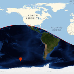
地図スタイル"CountryBorders"は他のGeoGraphics要素と一緒に使うこともでき,その基本指示子を変更することができる.
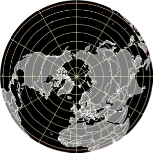
In[3]:=
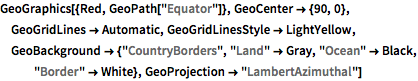
GeoGraphics[{Red, GeoPath["Equator"]}, GeoCenter -> {90, 0},
 GeoGridLines -> Automatic, GeoGridLinesStyle -> LightYellow,
 GeoBackground -> {"CountryBorders", "Land" -> Gray, "Ocean" -> Black,
    "Border" -> White}, GeoProjection -> "LambertAzimuthal"]
Out[3]=