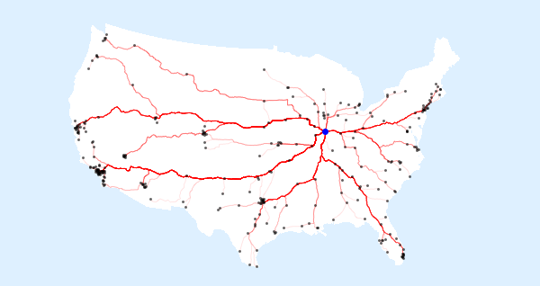
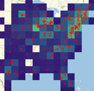
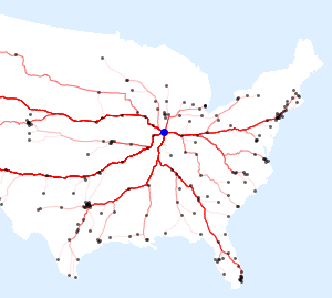
Drive to Champaign
Draw the roads from the 300 largest cities in the US to the headquarters of Wolfram Research in Champaign, IL.
In[1]:=
champaign = Entity["City", {"Champaign", "Illinois", "UnitedStates"}]Out[1]=
In[2]:=
us = Entity["Country", "UnitedStates"]Out[2]=
This is the list of the largest cities in the US.
In[3]:=
Length[cities = CityData[{Large, "UnitedStates"}]]Out[3]=
Compute travel paths to Champaign.
In[4]:=
roads = Quiet@TravelDirections[{#, champaign}, "TravelPath"] & /@
   cities;
Eliminate a few failed cases, like traveling from Honolulu to Champaign.
In[5]:=
Length[roads = Cases[roads, _GeoPath]]Out[5]=
Draw the map.
In[6]:=
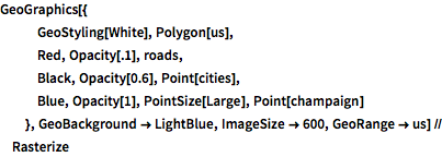
GeoGraphics[{
   GeoStyling[White], Polygon[us],
   Red, Opacity[.1], roads,
   Black, Opacity[0.6], Point[cities],
   Blue, Opacity[1], PointSize[Large], Point[champaign]
   }, GeoBackground -> LightBlue, ImageSize -> 600,
  GeoRange -> us] // Rasterize
Out[6]=