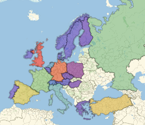
Границы стран
Используйте новый стиль контурной карты "CountryBorders".
In[1]:=
GeoGraphics["World", GeoBackground -> "CountryBorders"]Out[1]=

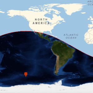
Границы страны могут быть заданы другим временем. Далее представлена часть Северной Америки в 1803 непосредственно перед покупкой Луизианы.
In[2]:=
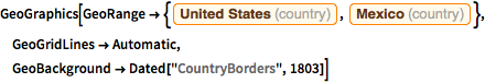
GeoGraphics[
 GeoRange -> {Entity["Country", "UnitedStates"],
   Entity["Country", "Mexico"]}, GeoGridLines -> Automatic,
 GeoBackground -> Dated["CountryBorders", 1803]]
Out[2]=

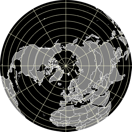
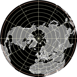
Стиль карты "CountryBorders" может быть объединён с другими элементами GeoGraphics, и её основные директивы могут быть изменены.
In[3]:=
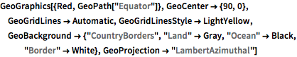
GeoGraphics[{Red, GeoPath["Equator"]}, GeoCenter -> {90, 0},
 GeoGridLines -> Automatic, GeoGridLinesStyle -> LightYellow,
 GeoBackground -> {"CountryBorders", "Land" -> Gray, "Ocean" -> Black,
    "Border" -> White}, GeoProjection -> "LambertAzimuthal"]
Out[3]=