Which Country Has This Bounding Box?
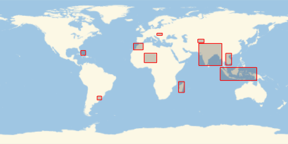
Draw latitude-longitude rectangles around 10 countries chosen randomly. How many can you recognize without seeing their actual shapes?
Take the list of all countries.
In[1]:=
Length[countries = EntityList[EntityClass["Country", All]]]Out[1]=
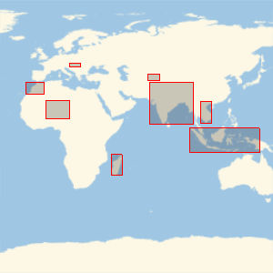
Choose 10 of them randomly but do not show their names!
In[2]:=
sample10 = RandomSample[countries, 10];Which countries have these geo bounding boxes?
In[3]:=
GeoGraphics[{EdgeForm[Red], GeoBoundsRegion /@ sample10},
 GeoBackground -> "StreetMapNoLabels", GeoRange -> "World"]
Out[3]=
Click here to see how many you recognized.
show complete Wolfram Language input