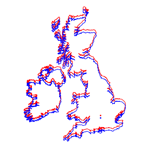
해안선에 도달하는 가장 빠른 방법
미국 본토의 각 주도에서 미국의 국경 지점까지의 최단 경로를 구합니다.
수도의 목록을 가져옵니다.
In[1]:=
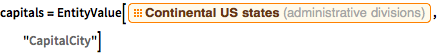
capitals =
 EntityValue[
  EntityClass["AdministrativeDivision", "ContinentalUSStates"],
  "CapitalCity"]
Out[1]=

미국의 다각형을 구합니다.
In[2]:=
us = EntityValue[Entity["Country", "UnitedStates"], "Polygon"]Out[2]=

각각의 수도로부터 다각형에서 가장 가까운 점을 계산합니다.
In[3]:=
borderpoints = Flatten[Nearest[First[us], GeoPosition[capitals]]]Out[3]=

모든 측지 경로를 그립니다.
In[4]:=
GeoGraphics[{us, Point[capitals], Red, Arrowheads[0.015],
  Arrow /@ GeoPath /@ Thread[{capitals, borderpoints}]}]
Out[4]=