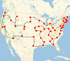
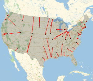
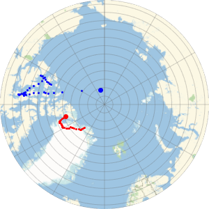
到海岸的最快路径
找出从美国本土各州州府到一个美国国界的最短的可能路径.
取得州府列表.
In[1]:=

capitals =
 EntityValue[
  EntityClass["AdministrativeDivision", "ContinentalUSStates"],
  "CapitalCity"]
Out[1]=

获取美国的多边形图.
In[2]:=
us = EntityValue[Entity["Country", "UnitedStates"], "Polygon"]Out[2]=

对每一个州府,计算多边图上与之相距最近的点.
In[3]:=
borderpoints = Flatten[Nearest[First[us], GeoPosition[capitals]]]Out[3]=

绘制全部测地路径.
In[4]:=
GeoGraphics[{us, Point[capitals], Red, Arrowheads[0.015],
  Arrow /@ GeoPath /@ Thread[{capitals, borderpoints}]}]
Out[4]=