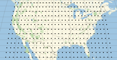
Grid of Geographical Locations
The new functions CoordinateBoundsArray and CoordinateBoundingBoxArray can be used to create multidimensional arrays of numerical values with specific steps.
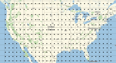
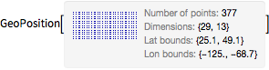
Compute the bounds of latitudes and longitudes for the US.
In[1]:=
{lat, lon} = GeoBounds[Entity["Country", "UnitedStates"]]Out[1]=
Generate from them an array of coordinates with a step of 2 degrees.
In[2]:=
arr = CoordinateBoundsArray[QuantityMagnitude@{lon, lat}, 2];Construct a geographical grid from the array.
In[3]:=
grid = GeoGridPosition[arr, "Equirectangular"];In[4]:=
pos = GeoPosition[grid]Out[4]=
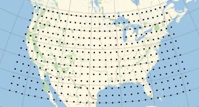
Plot those coordinates on a geographical map.
In[5]:=
graphics = GeoGraphics[Point[pos], GeoGridLines -> Automatic]Out[5]=
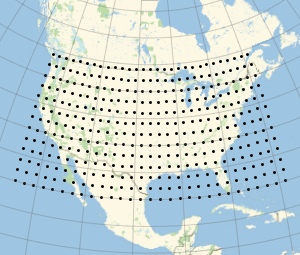
Plot the points in other projections.
In[6]:=
Show[graphics, GeoProjection -> "Mollweide"]Out[6]=
In[7]:=
Show[graphics, GeoProjection -> "Mercator"]Out[7]=