Satellitenkacheln für die Erde
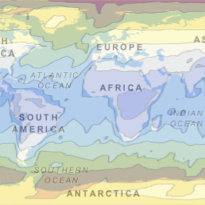
Dies ist ist eine Mercator-Karte der Erde unter Verwendung von bearbeiteten Satellitenbildern.
In[1]:=
GeoGraphics["World", GeoProjection -> "Mercator",
 GeoBackground -> "Satellite"]
Out[1]=

Verwenden Sie eine andere Projektion.
In[2]:=
GeoGraphics["World", GeoProjection -> "Mollweide",
 GeoBackground -> "Satellite"]
Out[2]=

Eine Karte mittleren Maßstabs.
In[3]:=
GeoGraphics[Entity["Country", "Australia"],
 GeoBackground -> "Satellite"]
Out[3]=

Zoomen Sie das Umland einer Großstadt heran.
In[4]:=
GeoGraphics[Entity["City", {"Sydney", "NewSouthWales", "Australia"}],
 GeoBackground -> "Satellite"]
Out[4]=