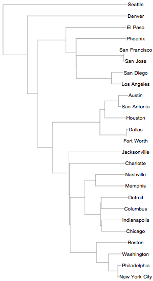
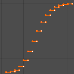
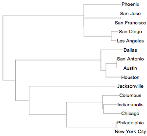
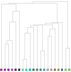
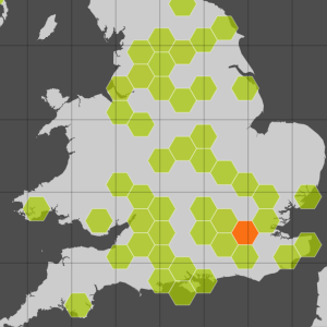
Grouping Cities by Distance
Create a hierarchical clustering of the 25 largest cities in the US based on the geographic distance between them.
In[1]:=
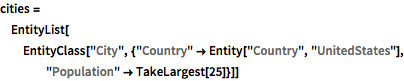
cities = EntityList[
  EntityClass[
   "City", {"Country" -> Entity["Country", "UnitedStates"],
    "Population" -> TakeLargest[25]}]]
Out[1]=
In[2]:=
Dendrogram[cities, Left, ImageSize -> 300]Out[2]=